


A Google Maps update unveiled Monday aims to streamline long-range electric vehicle road trips for Android Auto users. The navigation and mapping software can now automatically suggest charging stops when planning longer journeys in EVs, with more accurate arrival time and state-of-charge estimates based on how long its AI-powered routing algorithm thinks you'll need to plug in. Google says it has compatibility with EVs from 16 automakers -- comprising over 350 models and trim levels -- in the US.
Route-planning software has gotten significantly more sophisticated since the early days of electric motoring. Back in the day, going on an EV road trip required multiple mapping and EV charging network apps and careful planning to ensure you got where you were going. Even for those of us who knew what we were doing, it could be very stressful.
Today, nearly all modern EVs feature connected navigation that automatically suggests charging stops (often with live station availability) when planning routes longer than the vehicle's cruising range. Google Maps' new EV route planning function brings some of that new EV convenience to older models and to drivers who prefer the Google Maps and Android Auto ecosystem to their vehicle's onboard software.
Enlarge Image
Google Maps can use AI to estimate where and for how long you'll need to charge when planning a long EV trip.
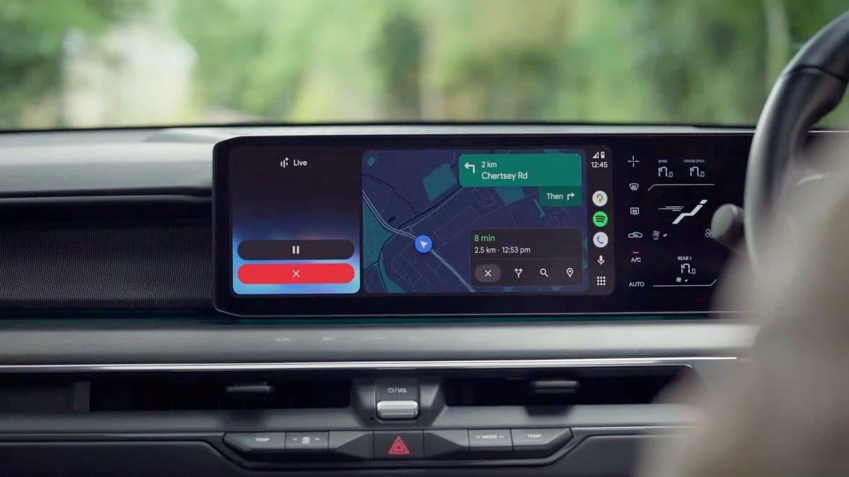
GoogleTo get the new EV route planning, go to the Google Maps app on your phone, find the settings and set your vehicle type to "Electric." Then add the year, make, model and trim and confirm what type of plug your EV uses (NACS, CCS, J1772, etc.) Now, when planning a long route via Android Auto in your car, Google Maps (version 25.44 and up) will display the estimated battery usage for your trip, recommended charging stops (if any), charge time estimates, and the estimated time and battery percentage on arrival.
Unlike vehicles with "Google Built-in" -- such as Volvo EVs, Polestar EVs, and GM models like the Blazer EV and Equinox EV -- phone-based Android Auto is currently unable to automatically pull live battery information from most cars. Instead, you'll be asked to manually input your current battery percentage before starting a trip. Google will use that number along with the EV's weight, battery size and EPA range, real-time traffic information, road elevation changes and weather data to deliver "accurate AI-powered predictions" for the route chosen.
Enlarge Image
Because phone-based Android Auto can't pull live battery data from the host car, you'll have to input (and update) your starting battery percentage before taking off.
GoogleHowever, that means Maps may not automatically update that estimate if your car doesn't perform like its AI model predicts. For example, if a heavier-than-average payload, additional equipment like a roof rack or trailer or under-inflated tires are dramatically reducing your efficiency, Android Auto and Google Maps may be blind to your range dropping faster than expected. As the saying goes, your mileage may (nay, it will almost certainly) vary, so I'd advise you to keep a close eye on your range.
Still, this new automatic charge plan generation sounds like a promising tool to boost convenience and reduce range anxiety at the beginning of a long journey. Being able to hop into an EV and hit the road with confidence is pretty sweet, especially for owners of older EVs who don't have access to onboard software for this sort of dynamic route planning.
You can check Google's site (or the settings page in the most recent Google Maps app) to see if your EV is among the 16 makes and 350-plus models and trim levels supported.