

Warning of record global temperatures as chance of very strong El Niño grows
Record global temperatures possible as chance of a 'super El Niño' grows
While El Niño forms across the tropical Pacific, forecasters look at one region in particular called the Niño3.4, monitoring a three-monthly average of the sea surface temperature compared to the long-term average.
A strong or 'super El Nińo' is when that goes above 1.5C.
Forecasts from the European Centre for Medium Range Weather Forecasts (ECMWF), NOAA and BoM are all pretty much aligned in their outcomes.
In the latest prediction from the ECMWF, more than half of their forecast models suggest a temperature of over 2.5C by the autumn.
Anything over 2.5C would be a "historically strong event," said Johnson.
BoM forecasts are also confidently showing the possibility of a very strong El Niño to develop later this year.
Some forecast data is even suggesting the temperature could exceed 3C, surpassing the current known peak of 2.7C recorded in 1877.
It should be noted this was a very different era with limited observations and so there remains a lot of uncertainty in the reported temperature.
That El Niño lasted around 18 months which triggered a catastrophic global climate event, causing extreme drought and widespread famine across Asia, Brazil, and Africa which killed millions, while producing severe flooding in other regions like Peru.
The last 'very strong' El Niño occured in 2015-2016 when the average three-monthly (November, December, January) Niño3.4 temperature reached 2.4C.
With the extra heat in the eastern Pacific, the biggest impact of El Niño is boosting global average temperature, typically by 0.2C.
Liz Stephens, professor of climate risk and resilience at the University of Reading told the BBC that we're "probably be looking at record global temperatures next year, especially if this is a very strong El Nino event".
Following the 2023/24 El Niño we saw the hottest year on record.
While you might see more direct weather impacts around the Pacific, every El Niño is unique in terms of its strength and how far reaching its disruption is to global weather patterns.
Flooding in northern Peru and southern Ecuador is common but also potentially in East Africa, central Asia and southern portions of North America.
It also suppresses Atlantic tropical storms. Forecasters are already suggesting this years Atlantic hurricane season is going to be quieter than average.
"While that sounds like a good thing, for Central America that leads to a lot less rainfall and potentially drought conditions," according to Prof Stephens.
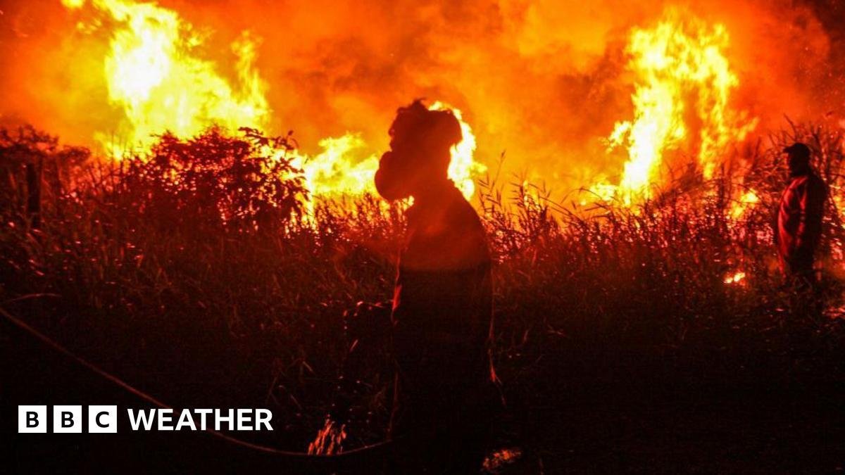
There is also a greater chance of drought and wildfires in parts of Australia, Indonesia and the north of South America, leading to a decline in agriculture and global food stocks.
Sponsor
Sponsor
Sponsor
Sponsor
Zoekertjes
Categorieën
Read More
Today's NYT Connections: Sports Edition Hints and Answers for June 16, #631Looking for the most recent regular Connections answers? Click here for today's Connections hints, as well as our daily answers and hints for The New York Times Mini Crossword, Wordle and Strands puzzles. Today's Connections: Sports Edition is a tough one. If you're struggling with the puzzle but still...

Situs toto adalah platform online yang menyediakan berbagai jenis permainan angka atau prediksi hasil undian. Istilah “toto” sendiri berasal dari permainan tebak angka yang sudah lama populer di berbagai situs togel . Kini, dengan perkembangan teknologi, permainan ini hadir dalam bentuk digital yang lebih praktis dan mudah diakses melalui perangkat seperti smartphone maupun...
After the level cap, Diablo 4 starts to feel less like a simple XP chase and more like a route-planning game. If you're trying to push War Plan skill trees quickly, your build matters as much as the content itself. You don't want a setup that wins slowly. You want one that moves, deletes packs, and keeps going. A Whirlwind Barbarian is a good example because it can stay in motion while tearing...

Dyson's New Fan and Air Purifier Combo Follows You Around the Room to Deliver Clean AirFans are among the best ways to stay cool in the summer. They're usually quiet, energy-efficient compared to air conditioners, and you can buy them in a variety of sizes and types, from tabletop and standing fans to larger tower fans and ceiling fans. It's hard to imagine how to improve on something...

NASA Orders ISS Crew Members to Briefly Shelter During Leak Repair WorkOn Friday, NASA directed five people on the International Space Station to temporarily shelter in a SpaceX Dragon spacecraft after engineers discovered air leakage in the Russian segment of the station. Four SpaceX Crew-12 crew members and NASA astronaut Chris Williams entered the SpaceX Dragon spacecraft in case NASA...